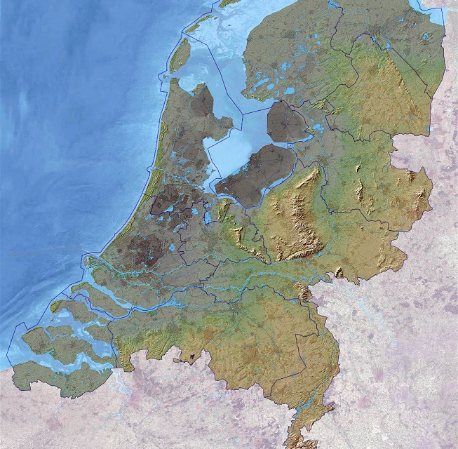
THIS IS the map that tells the entire story of the Dutch.
The darker colors show how the country is one-third below sea level. Lowest part is 22 ft under.
Highest part is in the deep, deep south of Limburg, Mount Vaals at 1,055 ft above. It is more ant hill than mountain.
Rivers Scheldt and Meuse enter from the South, river Rhine barges in from the east, and the Atlantic Ocean, locally known as North Sea, comes at them from west and north. In worst case scenarios, two-thirds of the Netherlands could be liable to flooding. Schiphol airport is built in the middle of that lake area in the west – on the bottom of a dry lake.
Yet the Dutch not only survive, but in the past 800 years they have almost doubled their land area. They are a population of 18 million, have ten times as many people per square mile as the USA, on a land area that is 235 times smaller.
Abundance of water and lack of space have forced the Dutch to become what they are today: the best protected against rising sea levels, and the world’s number one exporter of responsibly produced foods.
There you have it.


