RHODE Island has nothing to do with the Greek island of Rhodes or with Rhodesia.
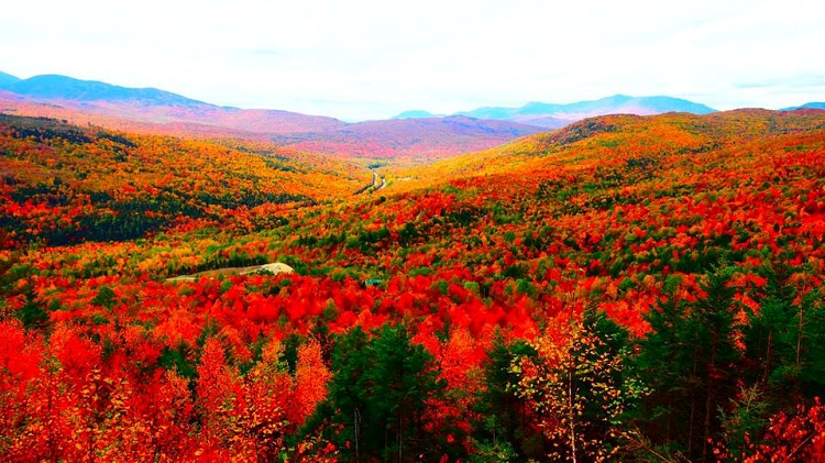
Amsterdammer Adriaen Block was the first to see it, from his ship. It was the autumn of 1614, the leaves were turning red, and Block was busy mapping America’s coast. Four times he sailed back and forth across the ocean, long before the Mayflower, between 1611 and 1614, and the last time his ship broke in two, just outside Manhattan.
The crew, with the assistance of local boys, made a new boat (and, with the help of local girls, babies, which is why many Lenape Nation people still walk around carrying surnames such as DeGroat, DeFreese and Van Dunk), and Captain Block christened that boat, understandably, Unrest.
With it, he inspected the coastline north of Lange Eiland, now Long Island, and was impressed by the autumn foliage that colors the US bright red and orange this time of the year. He discovered a river and named it River of the Red Hills, docked at an islet still called Block Island today, crossed to the mainland and saw how beautiful the coast looked with all those autumn colors. To top it off: the clay was red, too.
Roode Eylant, he called what he saw. And it’s still called that today.
Rhode Island.
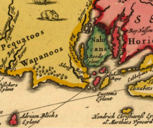
* The 17th-century map based on Block’s discoveries. Roode Eylant has a green border.